![]()
![]()
![]()
![]()

|
|
|
|
Click to enlarge image
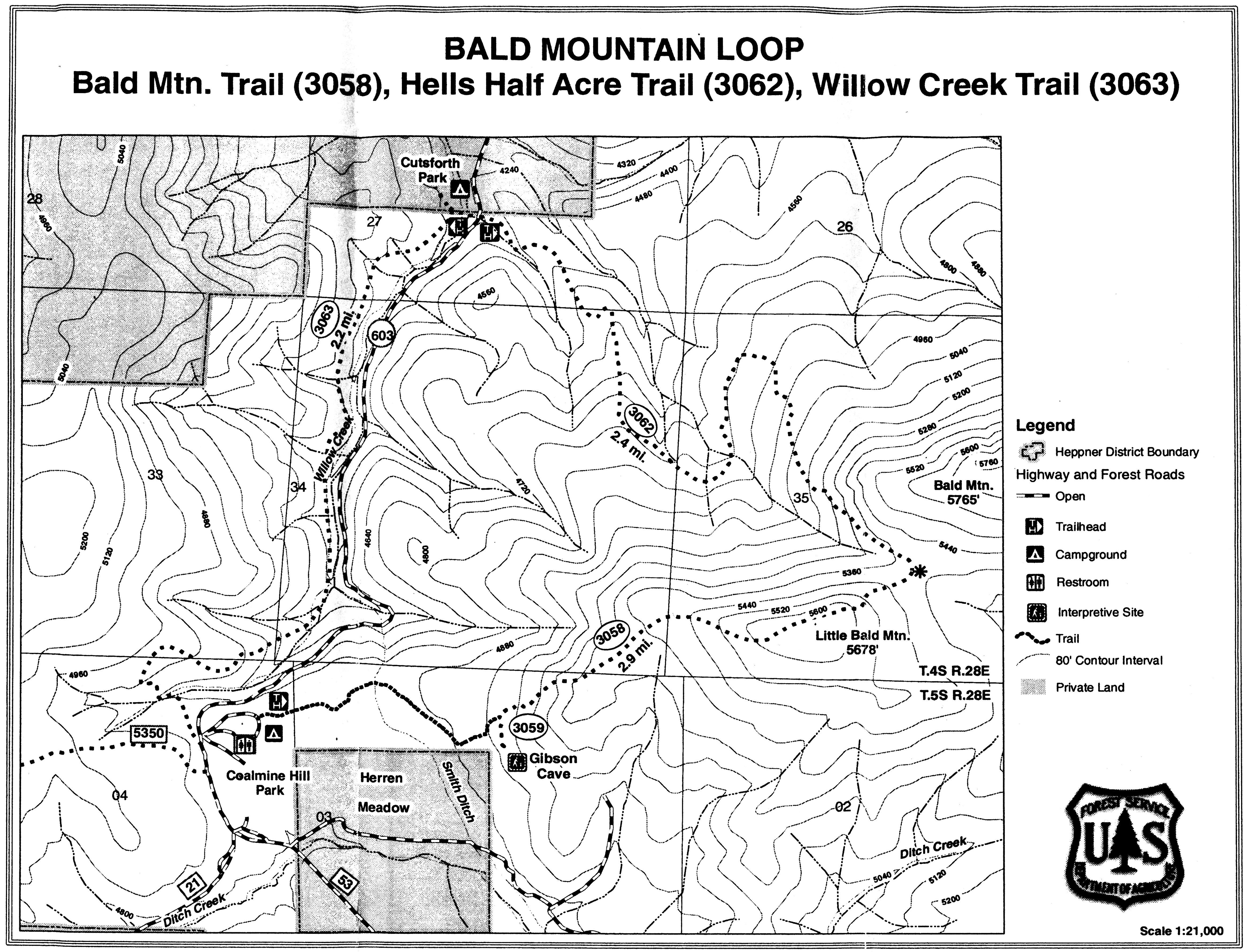
Willow Creek Trail #3063Elevation: 4300' The Willow Creek Trail is 2.61 miles and completes the 7.32-mile Bald Mountain Loop. The trail parallels Willow Creek. Remnants of past coal mining can be found along the trail. Bald Mountain Trail # 3058Elevation: 4800' The Bald Mountain Trail is 2.21 miles and is highlighted by the historical Smith Ditch built by the CCC for irrigation and water in the 1930's. Smith Ditch is 1/4 mile from the trailhead. Another mile will take you to Gibson Cave. Mr. Gibson lived in the cave in the 1930's and 1940's while he cut and sold firewood. The cave was also used by early native Americans. Hells Half Acre Trail # 3062Elevation: 4300' The Hells Half Acre Trail is 2.61 miles and take you to the unique "Earth Shake." The true history is not known, but locals claim an earthquake shaped the rock formation. This area is cool and damp and a great stop for an enjoyable picnic lunch. |
|
Send mail to
RRR with
questions or comments about this web site.
|